

Professional Drone Real Estate Appraisals in Toronto
Introduction
When it comes to real estate appraisals, accuracy and comprehensive data collection are paramount. At Drone View Toronto, we utilize advanced drone technology to offer highly accurate real estate appraisals. Our drone-based appraisals provide detailed aerial imagery, 3D models, and data that help property appraisers, real estate agents, and property owners make well-informed decisions.
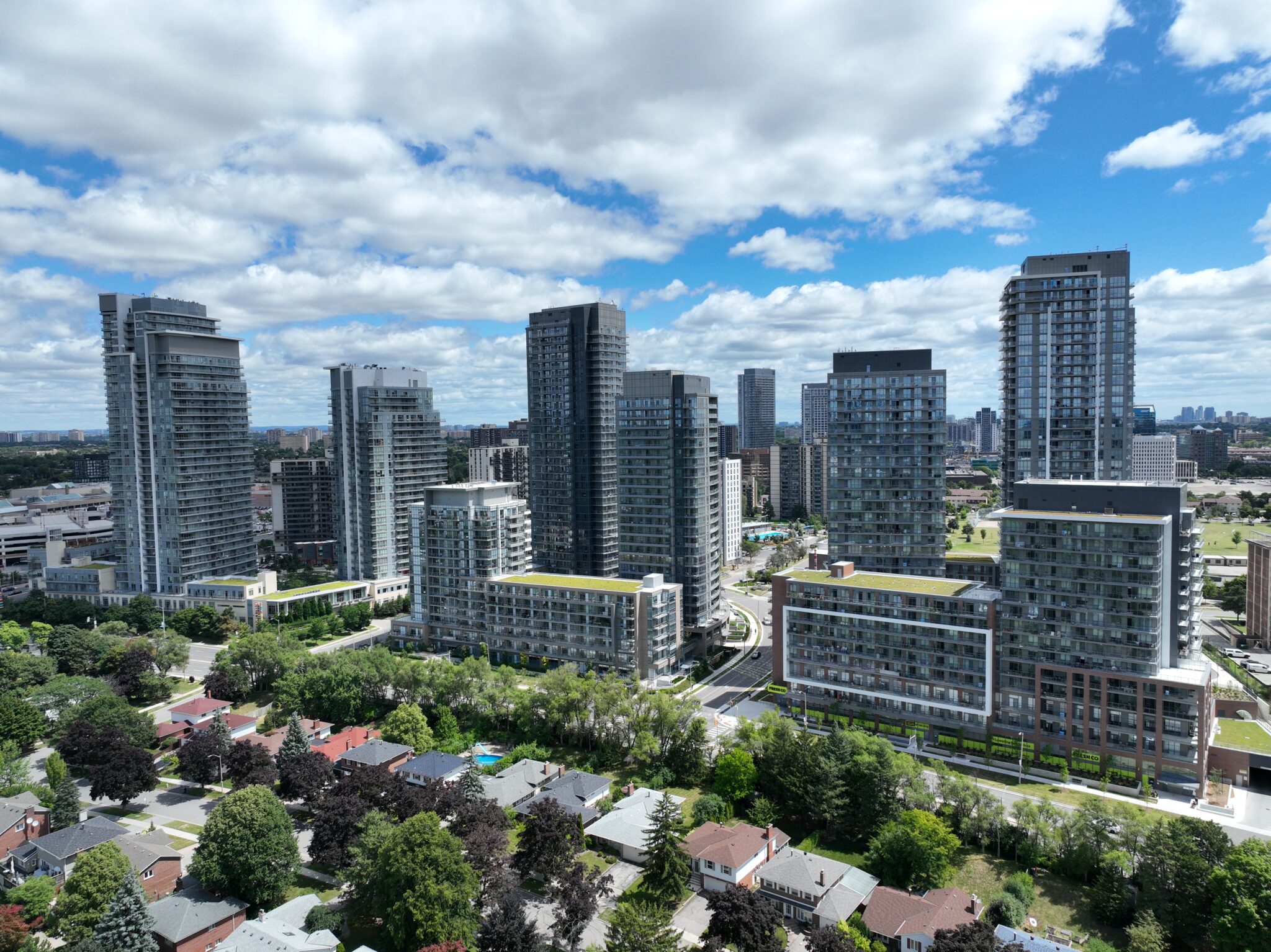
By offering a bird’s-eye view of properties, we ensure that no aspect of the land or building goes unnoticed, leading to more accurate valuations. Whether you’re assessing residential properties, commercial spaces, or large parcels of land, our drone services provide the clarity and precision needed to conduct thorough and efficient appraisals.
Why Use Drones for Real Estate Appraisals?
Drone technology is changing the way real estate appraisals are conducted. Here are the key reasons why drones are the future of property appraisals:
1. Increased Accuracy
Traditional methods of property appraisals can be limited by the inaccessibility of certain areas, especially when dealing with larger plots of land or complex structures. Drones can easily access hard-to-reach spots, providing a comprehensive aerial view of the entire property. This ensures that nothing is missed, and the final valuation is based on complete and accurate data.
2. Time Efficiency
With drones, appraisers can complete their evaluations much faster than using traditional methods. Aerial data can be collected in minutes, as opposed to hours or even days of manual measurement and assessment. This improves turnaround times and ensures that clients receive their property valuations promptly.
3. Comprehensive Data Collection
Drones don’t just provide pictures—they generate detailed data in the form of high-resolution images, 3D models, and orthomosaic maps. This data is incredibly useful for property appraisers to get an accurate assessment of the property’s dimensions, layout, and surrounding areas.
4. Cost-Effectiveness
By reducing the amount of time and manpower needed to conduct property assessments, drones lower the overall costs of the appraisal process. Clients can get more accurate and comprehensive appraisals at a lower price compared to traditional methods that require more resources.
5. Enhanced Visual Records
For real estate agents and property owners, drone-based appraisals offer the added benefit of aerial footage that can be used for marketing purposes or visual records. This additional data provides valuable insights that go beyond numbers, allowing clients to see the property in ways they couldn’t before.
Our Drone Real Estate Appraisal Services
At Drone View Toronto, we offer a range of services designed to enhance the accuracy and efficiency of property appraisals. Our drone services cover everything from residential homes to large commercial properties, and we tailor our approach to meet the specific needs of your appraisal.
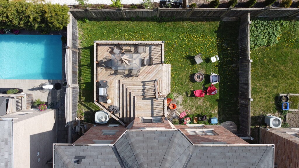
1. Aerial Property Assessments
Our drones capture high-resolution imagery and detailed topographical data of the property from multiple angles. This allows for a thorough assessment of property boundaries, landscaping, rooftops, and structures. Whether you’re appraising a single-family home or a multi-acre commercial property, our aerial assessments give you the complete picture.
2. 3D Modeling
We use advanced drone software to generate 3D models of the property. 3D models give a visual representation of the property, helping appraisers get a better understanding of building features, site dimensions, and overall property layout.
3. Site Inspections
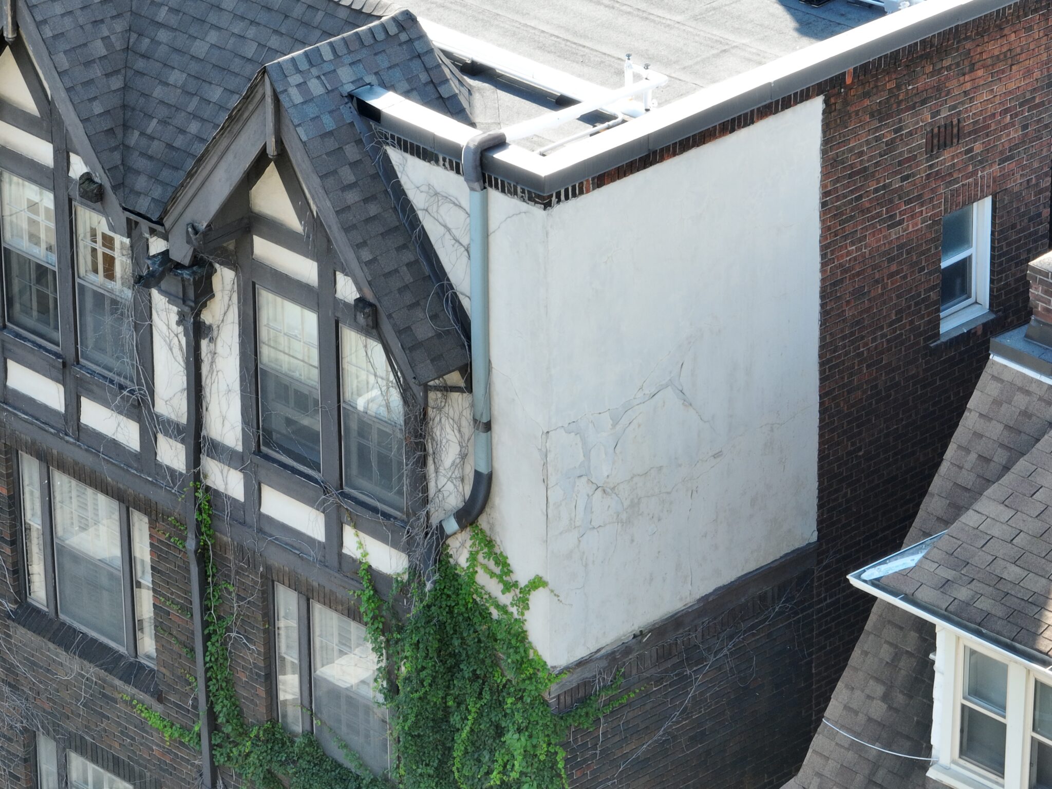
Drones provide a closer look at important elements of the property that might otherwise be overlooked, such as roof conditions, structural integrity, and landscaping. This helps appraisers to detect issues early and provide more accurate appraisals. For real estate professionals, this kind of detailed inspection data can also inform decisions about repairs or renovations that might increase property value.
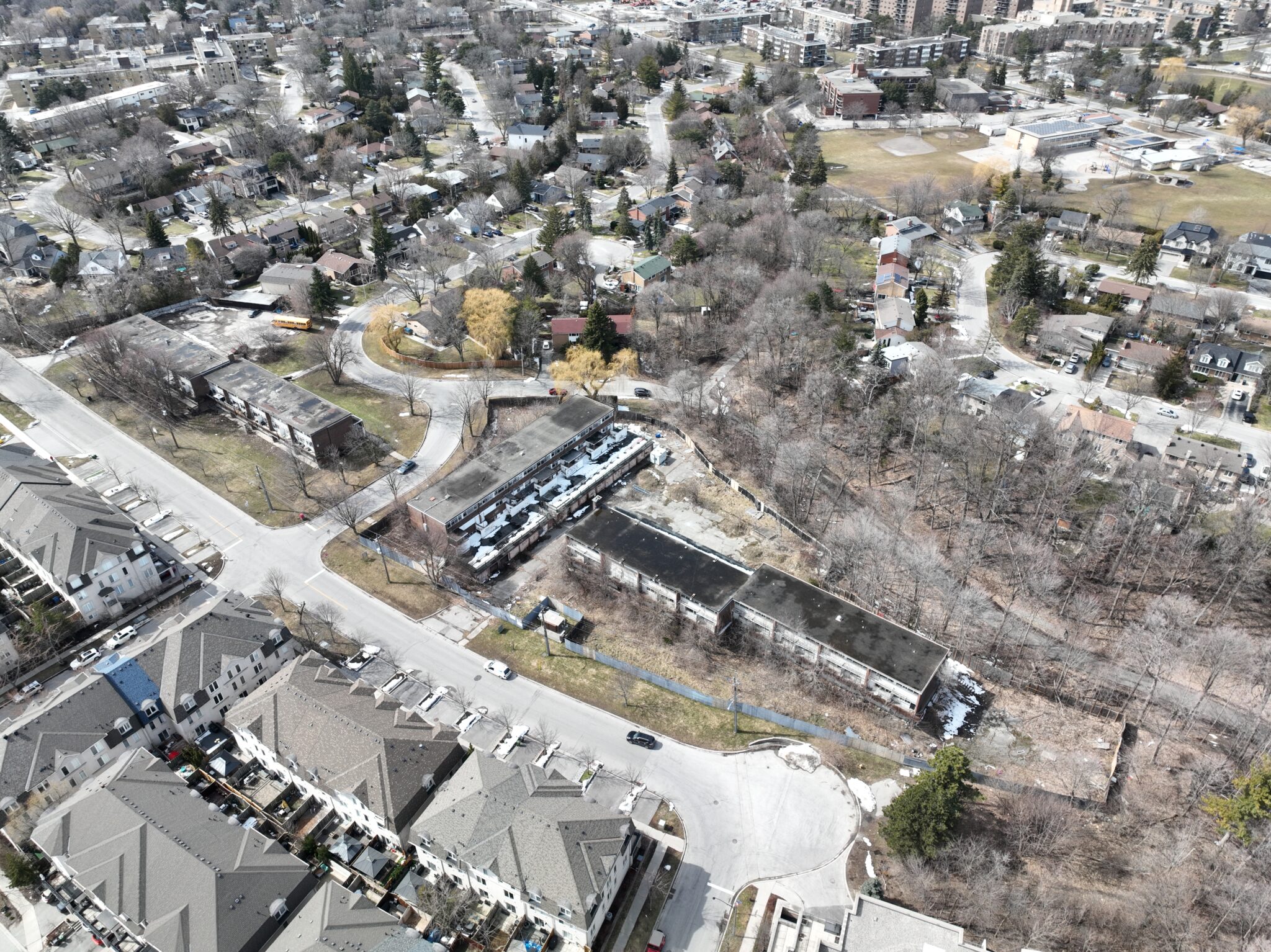
4. Large Land and Commercial Property Appraisals
For large land plots or commercial properties, drones are indispensable. They allow you to gather data on properties that would otherwise require hours of manual inspection. By providing aerial views, drones help appraisers assess the full value of sprawling properties that would be time-consuming to measure manually.
5. Post-Appraisal Reporting and Data
After collecting aerial data, we compile detailed reports that give property appraisers, real estate agents, and clients all the information they need for a thorough property valuation. These reports are easy to understand and include aerial images, 3D models, and data points that help appraisers determine the most accurate valuation possible.
How Drone Real Estate Appraisals Work
Step 1: Consultation and Planning
We begin by consulting with you to understand your specific appraisal needs. Whether it’s a residential property, a commercial site, or a large piece of land, we tailor our drone services to match the unique aspects of the property.
Step 2: Flight Planning
Our experienced drone pilots plan the flight routes, considering airspace restrictions and local regulations to ensure smooth operations. We schedule the flight at a time that’s convenient for you, with minimal disruption to the property.
Step 3: Data Collection
Once on-site, our drones capture high-quality images and detailed data from multiple angles. Depending on your needs, we provide 2D imagery, 3D models, and geospatial data that can be used to measure the property and assess its overall value.
Step 5: Delivery of Appraisal Data
Our team delivers all the collected footage. The is designed to provide property appraisers with a complete and accurate picture of the property’s value.
The Importance of Drones in Toronto’s Real Estate Market
The Toronto real estate market is highly competitive, and accurate appraisals are critical to making informed buying and selling decisions. In a market where even small differences in property value can have significant financial implications, drone-based appraisals offer the precision and comprehensive data needed to ensure accurate valuations.
In addition, Toronto’s dense urban landscape can make traditional appraisals challenging. With drones, you can assess properties even in difficult-to-reach locations, providing a complete view of the site and its surroundings.
Drone Real Estate Appraisal Frequently Asked Questions (FAQs)
Q: How do drones help in appraising large properties?
A: Drones can quickly and efficiently cover large areas, capturing high-quality imagery and data that allows appraisers to assess every aspect of the property—something that would take much longer with traditional methods.
Q: Is drone-based property appraisal accepted by banks and real estate agencies?
A: Yes, drone-based appraisals are becoming increasingly recognized and accepted by financial institutions and real estate professionals for their accuracy and efficiency.
Q: What kind of properties can drones appraise?
A: Drones can appraise any type of property, including residential homes, commercial buildings, agricultural land, and large estates.
Q: How long does the drone appraisal process take?
A: The data collection process usually takes under an hour, and footage is delivered within a few days, depending on the property size and the level of detail required.
Need an Accurate Property Valuation?
At Drone View Toronto, we’re here to make your property appraisal faster, more accurate, and cost-effective. Whether you’re a property appraiser, real estate agent, or property owner, our drone services can provide you with the precision and clarity needed to accurately determine property values.
Contact us today for a free consultation and learn how we can help elevate your real estate appraisals.